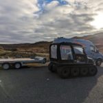
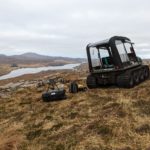
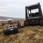
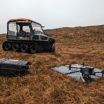
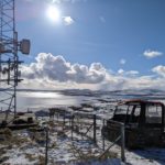
Out with our Argocat and DJI M300 with P1 sensor over in Uig on the west coast of the Isle of Lewis to carry out telecoms surveys.
Using the TopCon GNSS network rover, we were able to place GCP’s and CP’s around the sites to ensure accuracy during the UAV photogrammetry process. This allowed us to carry out accurate mapping of the sites, and provide our client with the elevations and contours in DXF format for further site build planning.
All our machines come with LANTRA trained and certified operators. Our machines are usually fitted with tracks to aid in access, but also to help reduce any wear and damage on the ground.